Quantcast
Channel: Explore Bangladesh: Foods, Heritage and Tourist Attractions
Viewing all 138 articles
Browse latest View live

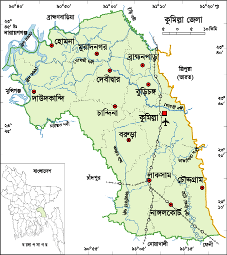
Comilla District Information

$
0
0

atlas of comilla


Comilla, Bangladesh

District Formation      : 1772
Under Division           : Chittagong
Previous Name           : Tripura
Area                          : 3,146.30 Sq Km
Population                 : 53,87,288
Sex Ratio                  : 92:100
Population Density     :1712/Sq Km
Growth Rate              : 1.58%
Literacy Rate             : 53.30%
Urbanization              : 15.60%
Upazilla                     : 16 (Comilla Sadar, Homna, Laksham,
                                         Muradnagor, Debidar, Barura, Daudkandi,
                                         Burichong, Chandina, Chaddagram, Nagolcot,
                                         Bhrammonpara, Meghna, Titas, Monohorgonj,
                                         Sadar Dokkhin)
Municipality               : 08
Union                        : 185
Village                       : 3532
Post Code                  : 3500.
NWD Code                 : 081
Parliament Seat        : 12
Lib. War Sector No     : 02
Rivers                       : Meghna, Gomati, Titas Dakatia, Kakri etc.
Agro Products            : Paddy, Jute, Wheat, Chilly, Onion, Garlic,
                                  Peanuts,Sugarcane,Yam,vegetables,Oilseed etc.

Remarkable Personalities: Prof. Mozaffor Ahmad, Dhrindra Nath Datta (Politician), A. T. M. Samsul Hoque (Politician), Khondaker Mostaq Ahmad (Ex-president), Azit Kumar guha (Writer), Anis Chowdhury (Writer), Nawab Fayjunnessa Chowdhury, Buddhyadeb Basu (Novelist), Sachin Deb Barman (Singer, composer & music director), Sursagor Himanshu Dutta,  Abul Khyer Muslehuddin (Writer), Monayem Sarker (Politician), Mobasher Ali (Literate Personality), Abdul Kadir (Poet), Moteher Hossain Chowdhury (Writer), Gias Kamal Chowdhury (Journalist), Basonta Kumar Majumder, Yousouf Abdullah Harun (Politician and Business Personality),Dr. Zobaida Hannan, Mahasthabir Shilvadra (great Buddhist monk & pandit), M.K. Anwar (Ex-minister), Shib Narayan Das (Freedom Fighter),  Air Vice-Marshall Mohammad Jamaluddin (ex-Chief of Staff of Bangladesh Air Force),Barrister Shafiq Ahmed (Politician), Advocate Abdul Motin Khosru, Kailashchandra singha (Historian), Mohamed Ali Azam (Educationist)etc.

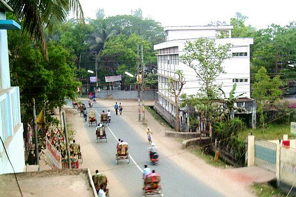
comilla, bangladesh
Tourist Spots: Kort-Bari, BARD, Moynamoti, Lalmay Hill, Shalbon Amorous Diversion, Second World War cemetery,Meghna-Gomoti Bridge, Bakhrabad Gas Field, Dhormosagor, Jagannath Bari Temple and Lake, Lateshor Lake, Core of Buddhist Civilization, Pashchimgaon Nawab Bari, Victoria College, Comilla Zilla School, Kutila Mura, Charandra Mura, Rupban Mura, Itakhola Mura, Satera Ratna Mura, Ranir Banglar Pahar, Ananda Bazar Palaces, palaces of Bhoj King, Shah Suja Mosque, Chandimata Mandir, Chandala Shiva Mandir, Mazars of Panch Pir (Five Saints), Harimangal Math, Ramnagar elongated Math, Saitshala Rammahan Mandir, Hasnabad Math,Town Hall Memorial etc.

Data Ref: Bangladesh Bureau of Statistics
District Portal
Banglapedia

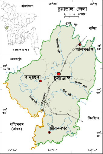
Chuadanga District Information

$
0
0

chuadanga district map

Chuadanga, Bangladesh

District Formation      : 1984
Under Division           : Khulna
Previous Name           : Gangaridhi
Area                         : 1,174.10 Sq Km
Population                 : 11,29,015
Sex Ratio                  : 100:100
Population Density     :962/Sq Km
Growth Rate              : 1.13%
Literacy Rate             : 45.90%
Urbanization              : 27.12%
Upazilla                     : 04 (Chuadanga, Alamdanga, Damurhuda,
                                         Jibonnagor)
Municipality               : 04 (Chuadanga, Alamdanga, Damurhuda,
                                         Jibonnagor)
Union                        : 32
Village                      : 521
Post Code                  : 9000.
NWD Code                 : 0761
Parliament Seat        : 02
Lib. War Sector No     : 08
Average Rainfall        : 1467 mm
Rivers                       : Naboganga,Mathavanga,Vairab,Kumar,Chitra etc.
Agro Products            : Paddy, Jute, Sugarcane, Betel Leaf etc.

Remarkable Personalities: Atul Kridna Saha (Leader of the Movement against British), Ananta Hari Mitra, Akram Ahmed (Bir-Uttam), Sree Hori Roy (Leader of Nil Rebellion) Kali Proshanna Chattergy (Editor), Dr Radha Binod Paul, Solaiman Haq Jowarder (Selun), Mr. Ali Ajgor (Togor) etc.

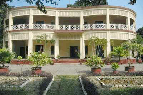
the one and only alcohol producer in bangaldesh
Tourist Spots: Ershad Baag and Fisheries, Dingedah Bazar, Alamdanga Rail-Way Station, Dorshana Rail-Way Station, Mazar of Khaza Malik-ul-Gaus (R), Dingedaha Meteri Fair, Goruy Tipy, Three domed Chuadanga Bôro Mosque, Gholdari Mosque, Natudah Atkabar, Hajar Duari School (Damuŗhuda), Karpashdaņa Neelkuţi, Gholdari Neelkuti etc.

Data Ref: Bangladesh Bureau of Statistics
District Portal
Banglapedia

Chittagong District Information

$
0
0

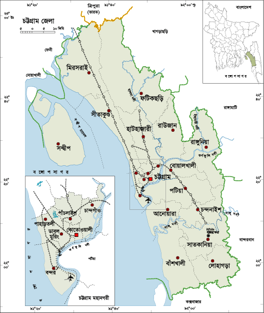
chittagong district map

Chttagong, Bangladesh

District Formation      : 1666
Previous Name           : Islamabad/Chattala/Chandgaon
Area                         : 5282.92 Sq Km
Population                 :76,16,352
Sex Ratio                  : 102:100
Population Density     :1442/Sq Km
Growth Rate              : 1.40%
Literacy Rate             : 58.90%
Urbanization              : 41.39%
City Corporation        : 01 (Chittagong)
Upazilla                     : 26
Municipality               : 10
Union                        : 194
Village                       : 1267
Post Code                  : 4000.
NWD Code                 : 031
Parliament Seat        : 16
Lib. War Sector No     : 01
Average Rainfall        : 3378 mm
Average Moisture       : 83%
Rivers                       : Karnafuli, Halda, Shangu, Feni etc.
Agro Products            : Paddy, Tobacco, Jute, Rubber, Coconut, Tea etc.

Remarkable Personalities: Masterda Surjasen, Priti Lota Owadder, Abdul Karim Sahittobisharod, Principal Abul Quashem (Educationist), Koreshi Magon  Thagure, Mohakobi Alaol, Kalpana Datta, Sayad Owali Ullah (Novelist), Binodbihari Chowdhury, Jahur Ahmad Chowdhury, M A Hannan, M A Aziz, Subrder Rajab Ali (Hero of Shipahi Revoloution), Kajem Ali Master, Comorad Mozaffor Ahmad, Jatindra Mohon Sen, Martyred Nirmol Sen, Amibca Chattargy, Gonesh Ghosh, Abdul Hoque Dovas, Rafiq Uddin Shiddique, Brozen Sen, Sharat Kanungo, Kalipod Chattargy, Prof. Pulin Day, Amor Sen, Comored Abdus Satter, A K Khan, Chowdhury Harunur Rashid, Captain Abul Quashem, Shirajul Hoque Mia, Khanbahadur, Natun Chandra Shingha, Probal Chowdhury, Sujat Roy, Ayub Bacchu, Nakib Khan, Roby Chowdhury, Partha Barua Dr Keshob Sen, Dr Harihar Datta, Jotirmoye Chowdhury, Kabial Romesh Shil, Shah Muhammad Sagir (Poet)  etc.

chittagong, bangladesh
Tourist Spots: Fays Lake, Potenga Sea Beach, Chittagong Zoo, Chittagong University, Graveyard of Bayajid Bostami, Graveyard of Shah Amanat, War Cemetery, Zia Memorial Museum, Asian Women University, Fauzdarhat Cadet College, Mahuri Project, Batali Hill, Chandranath Hill of Shitakunda, Hot Water Fall, Bashkhali Eco Park, Parky Sea Beach in Anowara, Bangladesh Military Academy, Marine Academy etc.

Data Ref: Bangladesh Bureau of Statistics
District Portal
Banglapedia

Chapai Nawabganj District Information

$
0
0

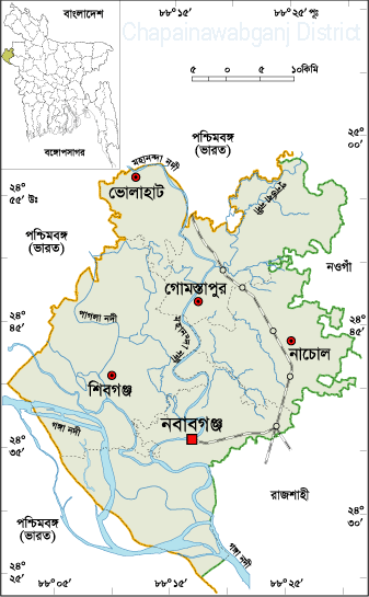
Chapai Nawabganj District Map, Bangladesh

Chapai Nawabganj, Bangladesh

District Formation      : 1984
Under Division           : Rajshahi
Area                          : 1702.55 Sq Km
Population                 : 16,47,521
Sex Ratio                  : 97:100
Population Density     :968/Sq Km
Growth Rate              : 1.44%
Literacy Rate             : 42.90%
Urbanization              : 19.44%
Upazilla                     : 05 (Chapainababganj, Shibgonj, Nachole,
                                         Gomastapur, Volahat)
Municipality              : 04 (Chapainababganj, Shibgonj, Rohonpur,
                                         Nachole)
Union                        : 45
Village                       : 1135
Post Code                  : 5280.
NWD Code                 : 0781
Parliament Seat        : 03
Lib. War Sector No     : 07 
Rivers                       : Padma, Mohanonda, Punarbhaba, Tangon,
                                  Maragada, Pagla, Nondaguja etc.
Agro Products            : Mango, Guava, Jack-Fruit, Water Melon, Maize,
                                  Litchi, Oilseed etc.

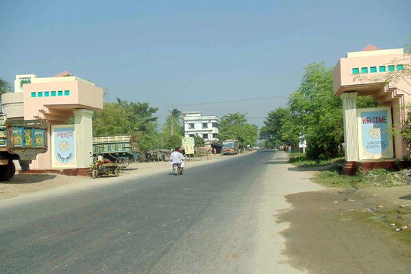
Remarkable Personalities: Diantullah Chowdhury (Hero of Nill Movement), Girish Chandra Singha (Land Lord), Prof. Abdur Rahim (Mathematician), Kutub Uddin (Pioneer of Gamvhira), Sayad Ali Ashraf, Sahabuddin Nagori (Singer), Momtaz Uddin Ahmad (Writer and Play Personality), Abdul Hoque, Rafiqunnabi (Artist), Prof. Moniruzzaman Mia, Justice Mainur Reza Chowdhury etc. Chapainawabganj, Bangladesh 
Tourist Spots: Choto Sona Mosque, Rajshadin Gaur of Bokhtier Khalgi, Graveyard and Mango Orchard of Shah Neamot Ullah etc, Kanchat Rajbari, Sah Suja Hambolkhana, Nowda Tomb, Darsbari, Shibmondir and couple of Temp in Huzabpur, Darashbari Mosque, Royal palace,  Baragharia Kacharibari (Revenue Office), Chapai Mosque, Naoda Stupa (Buddhist monument),  Nachole Palace, Adina College and Idrishi Bhaban etc. 

Data Ref: Bangladesh Bureau of Statistics
District Portal
Banglapedia

Chandpur District Information

$
0
0

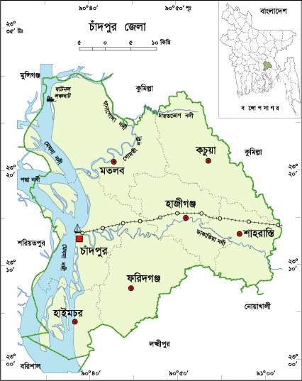
chandpur district map

Chandpur, Bangladesh

District Formation      : 1984
Under Division           : Chittagong
Area                         : 1,645.32 Sq. Km.
Population                 : 24,16,018
Sex Ratio                  : 90:100
Population Density     : 1468/Sq Km
Growth Rate              : 0.61%
Literacy Rate             : 56.80%
Urbanization              : 18.03%
Upazilla                     : 08 (Chandpur, Motlob North, Motlob South,
                                         Haymchar, Hazigonj, Kachua, Shaharasti,
                                         Faridgonj)
Municipality               : 06 (Chandpur, Hazigonj, Faridgonj, Kachua,
                                         Motlob, Chengarchar, Shaharasti)
Union                        : 88
Village                      : 1230
Post Code                  : 3600.
NWD Code                 : 0841
Parliament Seat        : 05
Lib. War Sector No     : 02
Rivers                       : Meghna,Dakatia,Dhonagoda,Motlab,Udhamdi etc.
Agro Products            : Paddy, Jute, Sugarcane, Wheat, Betel Nuts,
                                   Vegetables etc.

Remarkable Personality: Md Nasir Uddin, (Editor), Burhan Uddin Khan Jahangir (Literate Personality)Mohiuddin Khan Alamgir(Politician), Muntasir Mamun (Historian), Mizanur Rahaman Chowdhury (Politician), Samsul Arefin (Literate Personality), Journalist Nasiruddin, Mawlana Abdul Mannan (Politician), Artist Hashem Khan etc.

chandpur, Bangladesh
Tourist Spot: Chandpur River Port, River Research Institute, Remnants of the Nasir Court fort, Baraduara, Historical Baro Mosque of Hazigonj, ICDDR,B in Motlob, Monoshamura, Meghna-Dhangoda Barrage, Nilkuthi, Sahsuja Mosque, Shah Rasti Dargah, Begum Mosque, Hajiganj Bara Mosque, Alamgiri Mosque, Mada Khan Mosque, Kali temple, Lohagara ashram, Naorai ashram, Tultuli (Kachua) ashram etc.

Data Ref: Bangladesh Bureau of Statistics
District Portal
Banglapedia
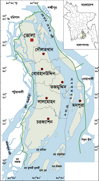
Brahmanbaria District Information

$
0
0

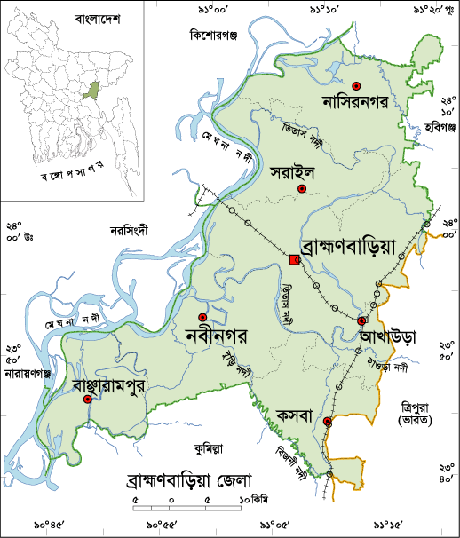
brahmanbaria map

Brahmanbaria, Bangladesh

District Formation      : 1984
Under Division           : Chittagong
Area                         : 1,881.20 Sq Km
Population                 : 28,40,498
Sex Ratio                  : 93:100
Population Density     : 1510/Sq Km
Growth Rate              : 1.68%
Literacy Rate             : 45.30%
Urbanization              : 15.79%
Upazilla                     : 09 (Brahamanbaria, Akhaura, Kosba,
                                        Bangarampur, Sarail, Nabinagor,
                                        Nasirnogor, Ashugonj, Bijoy Nagor)
Municipality               : 04 (Brahamanbaria, Ashugonj, Nabinogor, Kasba)
Union                        : 100
Village                      : 1323
Post Code                  : 3526.
NWD Code                 : 0851
Parliament Seat        : 06
Lib. War Sector No     : 02 and 03
Average Rainfall        : 78.06 cm
Rivers                       : Meghna, Titas, Shalda, Hawra, Pagla, Putia,
                                  Sonai, Hawra, Ropa, Buri, Bizna, Balua, Bolak,
                                  Dholbanga etc.
Agro Products            : Paddy, Jute, Mastered, Onion, Garlic, Pulses,
                                  Pine-Apple, Vegetables etc.

Remarkable Personalities: Addyata Mollobormon (Novelist), Ostad Ayet Ali Kha (Musical Talent), Ostad Alauddin Kha (Musical Talent), Nawab Syed Shamsul Huda, Samaul Hoque (Poet), Ostad Khadem Hossain Kha (Music Personality), Haralal Roy (Writer), Ma Anyandamoye, Sayed Samsul Huda (Educationist), Oli Ahad (Language Fighter), Al Mahmud (Poet), Ali Imam (Literate Personality), Sayad Abdul Hadi (Singer), Safic Rehman (Editor), Subol Das (Composer), Alamgir (Film Actor), Abdul Kadir (Poet) etc.

brahmanbaria, bangladesh
Tourist Spots: Titas Gas Field, Graveyard of Birshresta Mostafa Kamal, Kasba Kollapathar Somadhi, Faruque Park, Graveyard of Kallishid (R), Home of Ostad Alauddin Kha, Hatirpul, Home of Biplobi Ullash Datta, Gonga Sagor, Meghna Bridge, Ashugonj Power Station, Jadughor Sahi Mosque, Haripur Landlord Palace etc.

Data Ref: Bangladesh Bureau of Statistics
District Portal
Banglapedia
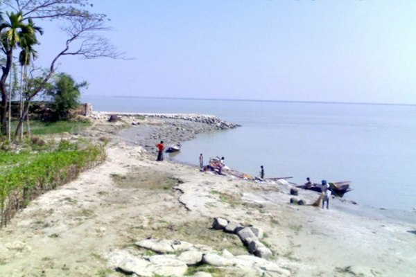

Barguna District Information

$
0
0

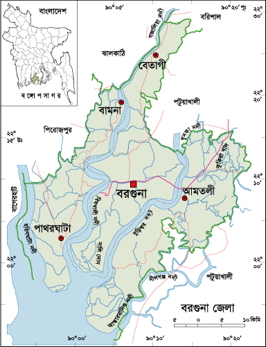
barguna map

Barguna, Bangladesh

District Formation      : 28 February 1984
Under Division           : Barisal
Area                          :1,831.31 Sq Km
Population                 : 8,92,781
Sex Ratio                  : 96:100
Population Density     : 488/Sq Km
Growth Rate              : 0.50%
Literacy Rate             : 57.60%
Urbanization              : 11.55%
Upazilla                     : 05 (Barguna, Patharghata, Bamna, Betagi, Amtoli)
Pourashava                : 04 (Barguna, Patharghata, Betagi, Amtoli)
Union                        : 42
Village                      : 562
Post Code                  : 8700.
NWD Code                 : 0448
Parliament Seat        : 02
Lib. War Sector No     : 09
Rivers                       : Haringhata, Biskhali, Dhaleswar, Adhar-Manik,
                                  Cheghai, Burishar, Khakdon, Rajgonj etc.
Agro Products            : Paddy, Jute, Pulse, Banana, Papaya,
                                   Vegetables etc.

Remarkable Personalities: Prof. Sayad Fazlul Hoque, Shelina Hossain (Novelist), Motin Boiragi, Abdul Aziz Master, Dr Entaz Uddin, Delower Hossain Montu, Motiur Rahaman Talukder, Gazi Ali Ahmed etc.

barguna, bangladesh
Tourist Spots: Fatrar Char, Ashar Char, Haringhata Forest, Laldiar Char and Sea Beach, Taltoli Rakhain Palli and Temple, Sonakata Forest, Donbunia, Mazhirchar, Khoyra Mosque, Samudra-Bilash, Bibichini Shahi Mosque etc.

Data Ref: Bangladesh Bureau of Statistics
District Portal
Banglapedia
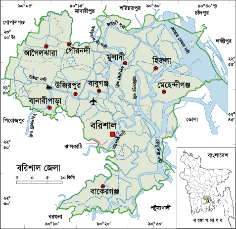
Bogra District Information

$
0
0

bogra map

Bogra, Bangladesh

District Formation      : 1950
Under Division           : Rajshahi
Previous Name           : Pundabardhan
Area                          : 2898.68 Sq Km
Population                 : 34,00,874
Sex Ratio                  : 101:100
Population Density     :1173/Sq Km
Growth Rate              : 1.20%
Literacy Rate             : 49.40%
Urbanization              : 19.71%
Upazilla                     : 12 (Bogra Sadar, Dhupchia, Adamdighi,
                                         Shibgonj, Dhunat, Shariakandi, Sonatola,
                                         Nondigram,Gabtali,Kahalu,Sherpur,Mazhira)
Municipality               : 11
Union                        : 110
Village                      : 2618
Post Code                  : 6600.
NWD Code                 : 051
Parliament Seat        : 07
Lib. War Sector No     : 07
Rivers                       : Jamuna, Kartoa, Nagor, Bangali, Halhalia,
                                  Dakuria, Belai, Gazaria, Chandraboti, Manash,
                                  Iramoti, Velka etc.
Agro Products            : Sugarcane, Tobacco, Paddy, Jute etc.

Remarkable Personalities: Major Ziaur Ziaur Rahaman( Politician), Noresh Chandra Sen Gupta, Bulbul Chowdhury, Akhtaruzzaman Ilias (Writer), Sadot Ali Akhondo (Literate Personality), Azizul Hoque (Poet), Enamul Hoque (Writer), Lutfar Rahaman Sarker, Sayad Anower Hossain, Chowdhury Mohammad Ali (Politician), Aminul Karim Dulal (Fine Atirst), Anjuma Ara Begum (Singer), Khandaker Faruque Ahmed, Gaziul Hoque (Language Fighter), M. R. Akhter Mukul etc.

bogra, bangladesh
Tourist Spots: Nawabbari, Kherua Mosque, Mohastangor, Shila Debir Hat, Behula – Luxindor er Bashor Ghor, Vasu Bihar, Bhabani Temple, Graveyard of Shah Sultan Balkhi (R), Bhabanipur Shib Mondir Kherua Mosque in Sherpur, Mohammad Ali Palace, Groan Barrage in Sariakandi, Wonderland etc.

Data Ref: Bangladesh Bureau of Statistics
District Portal
Banglapedia
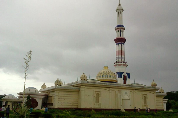

Bhola District Information

$
0
0

bhola map

Bhola, Bangladesh

District Formation      : 1980
Under Division           : Barisal
Previous Name           : Sahbazpur
Area                          : 3,403.48 Sq Km
Population                 : 17,76,795
Sex Ratio                  : 99:100
Population Density     : 522/Sq Km
Growth Rate              : 0.42%
Literacy Rate             : 43.20%
Urbanization              : 13.69%
Upazilla (Sub-District): 07 (Bhola Sadar, Charfashion, Monopura,
                                   Lalmohon,Daulatkhan,Tazumaddin,Borhanuddin)
Municipality               : 05 (Bhola, Charfashion, Borhanuddin,
                                   Daulatkhan, Lalmohon)
Union                        : 68
Village                      : 438
Post Code                  : 8300.
NWD Code                 : 0491
Parliament Seat        : 04
Lib. War Sector No     : 09
Rivers                       : Meghna, Tetulia, Ilsha, Boalia etc.
Agro Products            : Paddy, Jute, Potato, Onion, Garlic, Chilly, Peanuts,
                                   Mastered, Banana, Coconut, Vegetables etc.

Remarkable Personalities: Birshresta Mostafa Kamal, Tofayal Ahmed (Politician),Mozammel Hoque (Poet), Dr Abul Hasan Shamsuddin (Educationist), Firoza Begum (Educationist) Naziur Rahaman Monjur (Politician), Mosharof Hossain Shajahan (Politician), Nasir Ahmed  etc.

bhola, bangladesh
Tourist Spots: Monpura, Bhola Shishu Park, Bhorhanuddin helipad,Shabazpur Gas Field, Monopura Island, Graveyard of Tofayel Shah, Kobi Mozammel Hoque Gateway etc.

Data Ref: Bangladesh Bureau of Statistics
District Portal
Banglapedia

Barisal District Information

$
0
0

barisal map

Barisal, Bangladesh

District Formation      : 1797
Previous Name           : Chandradip/Bakla/Ismailpur
Area                         : 2,784.52 Sq Km
Population                 : 23,24,310
Sex Ratio                  : 96:100
Population Density     :835/Sq Km
Growth Rate              : -.13%
Literacy Rate             : 61.20%
Urbanizarion              : 22.33%
City Corporation        : 01 (Barisal)
Upazilla                     : 10 (Barisal Sadar, Bakergonj, Babugonj,
                                         Mehidigonj, Muladi, Uzirpur, Hizla,
                                         Agoirjhara, Gournadi, Banaripara)
Municipality               : 05 (Mehidigonj, Bakergonj, Muladi, Banaripara,
                                         Gaurnadi)
Union                        : 85
Village                      : 1116
Post Code                  : 8200.
NWD Code                 : 0431
Parliament Seat        : 06
Lib. War Sector No     : 08 and 09
Rivers                       : Meghna, Kittonkhola, Arial-Kha, Tetulia, Biskhali,
                                  Kalabador, Lohania, Ramgonj, Gojalia etc.
Agro Products            : Paddy, Jute, Sugarcane, Onion, Guava,
                                  Betel Leave, Mango, Jack-fruit, Banana,
                                  Vegetables, Oilseed etc.

Remarkable Personality: Birshresta Mohiuddin Jahangir, Ashini Klumar Datta(Poet), Major Abdul Jalil, Sashivhusan Das Gupta (Poet), Abdul Jabbar Khan (Singer), Humayun Kabir (Writer), Abdul Gaffar Chowdhury (Writer and Journalist), Abu Jafor Obaidullah (Writer and Poet), Asad Chowdhury (Poet), Sarder Fazlul Karim(Writer), Sufia Kamal (Poet), Adi Kobi Minnath, Monosha Mongol Poet Bijoy Gupta, Mukunda Das (Poet), Abdur rahaman Biswas (Politician), Shere Bangla A. K. Fazlul Hoque(Politician), Altaf Mahmud (Music Director), Jibananda Das (Poet), Abdul Rob Sherniabat(Politician), Golam Mostafa (Actor), Subarna Mostafa(Actress), Papia Sarwar (singer), Rejowana Chowdhury Bannya (Singer), Amrita Lal Day (Writer), Mithun Chakroborti (Indian Hero), Rashed Khan Menon (Politician) etc.

barisal, bangladesh
Tourist Spot: Brojomohan University College, Village of Sher-e-Bangla Chakher, Sher-e-Bangla Medical College, Durgasagor Lake, Subabad Fort, Shankor Temple, Jora Mosque, Sujabad Fort, Sangram Fort, Narikel Fort, Sher-e-Bangla Museum, The Bangabandhu Uddan (former Bell's Park), Shahid Abdur Rab Serniabat Bridge etc.

Data Ref: Bangladesh Bureau of Statistics
District Portal
Banglapedia
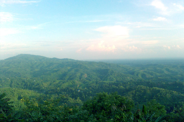
Bandarban District Information

$
0
0


Bandarban, Bangladesh

District Formation      : 1984
Under Division           : Chittagong
Previous Name           : Bohmong Htaung
Area                          : 4,479.01 Sq Km
Population                 : 388,335
Population Density     :87/Sq Km
Growth Rate              : 2.64%
Sex Ratio                  : 100:110
Literacy Rate             : 35.90%
Urbanization              : 25.86%
Upazilla                     : 07 (Bandarban, Rawoangchari, Naikharchari,
                                         Alikadam, Ruma, Thanchi, Lama)
Municipality               : 02
Union                        : 30
Village                      : 1554
Post Code                  : 4600.
NWD Code                 : 0361
Parliament Seat        : 01
Lib. War Sector No     : 01
Rivers                       : Matamuhari, Shankha, Rankhiang etc.
Agro Products            : Paddy, Jute, Pine-Apple, Orange, Banana etc.

Remarkable Personalities: Koarsha ong Marma, Mongsha Pru, Dr Mang Usha, Thoai Marma, Dr Prushanu Marma etc.

bandarban, bangladesh

Tourist Spots: Bomang Royal Palace, Baktai and Pukura Para Cascade, Bijoy the Highest Peak of Bangladesh, Keokaradong Peak,Meghla Parjatan Complex, Nilachal, Shoila Propat, Prantik Lake, Chimbuk, Boga Lake, Rijuk Fall, Keokradong, Tahjingdong, Shangu River, Golden Temple, Nilgiri, Mirinja Parjatan,Upabon Parjatan etc.
 
Data Ref: Bangladesh Bureau of Statistics
District Portal
Banglapedia
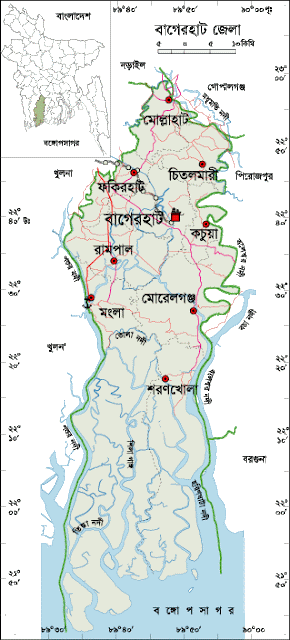
Bagerhat District Information

$
0
0


Bagerhat, Bangladesh


District Formation      : 23 February 1984
Under Division           : Khulna
Previous Name           : Khalifabad
Area                          : 3,959.11 Sq Km
Population                 : 1,476,090
Sex Ratio                  : 101:100
Population Density     : 373/Sq Km
Growth Rate              : - 0.47% 
Literacy Rate             : 59%
Urbanization              : 13.23%
Upazilla                     : 09 (Bagerhat,Mollarhat,Fakirhat,Mongla,Kachua,
                                         Rampal,Sharankhola,Moralgonj,Chitalmari)
Municipality               : 03 (Bagerhat, Mongla, Moralgonj)
Union                        : 76
Village                      : 1048
Post Code                  : 9300.
NWD Code                 : 0468
Parliament Seat        : 04
Lib. War Sector No     : 08 and 09
Rivers                       : Mongla, Modhumoti, Shila, Haringhata,
                                  Baleshari, Pathuria, Bangra etc.
Agro Products            : Coconut, Betel Nut, Paddy, Jute, Banana,
                                  Shrimp etc.

Remarkable Personalities: Dr Nilima Ibrahim(Writer), Sree Das Gupta (Politician), Rudra Mohammad Shahidullah (Poet), Prof. Abdullah Abu Sayed (Writer and Social Worker), Abu Baker Shiddique, Sheikh Amjad Ali, Kiron Chandra Roy, A. S. M. Mostafizur Rahaman, Prof. Moazzem Hossain etc.

bagerhat, bangladesh
Tourist Spots: Shat Gambuj Mosque, Mosque City of Bagerhat, Graveyard and Lake of Khan Jahan Ali, Ghoradighi,Mongla Sea Port, Sundarban, Robart Morel Monument, Modhumala Temple and Lake, Buffalo Cultivation Centre, Panighata Lake, Sona Mosque, Ajoddha Temple, Shib Temple, Hiron Poient, Tagore Lake, Rampal Lake, Seven and Nine Tomb Mosque, Kodla Math, Durgapur Shiva Math, Mongla Sea Port  etc.
Data Ref: Bangladesh Bureau of Statistics
District Portal
Banglapedia
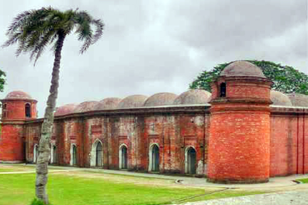
Rangpur Division in Bangladesh

$
0
0

Rangpur Division, Bangladesh


Established                : 25 January 2010
Area                          : 16,185.01Sq Km
Population                : 1,57,87,758
Sex Ratio                  : 100:100
Population Density     : 975/Sq Km
Annual Growth Rate  : 1.30% 
Literacy Rate             : 47.20%
Urbanization              : 13.36%
Total District              : 08


            1. Rangpur 
            2. Dinajpur
            3. Gaibandha 
            4. Kurigram 
            5. Lalmonirhat 
            6. Nilphamari
            7. Panchagarh
            8. Thakurgaon
Biggest District          : Dinajpur (3444.30 Sq Km)
Smallest District        : Lalmonirhat (1247.37 Sq Km)
City Corporation         : 01
Municipality               : 27
Upazilla                     : 58
Union                        : 539
Village                      : 9050
Parliament Seat         : 33


Data Ref: Bangladesh Bureau of Statistics
  Bangladesh census report-2011

Sylhet Division in Bangladesh

$
0
0

Sylhet Division, Bangladesh

Established                : 01.08.1995
Area                          : 12,635.24 Sq Km
Population                : 99,10,219
Sex Ratio                  : 99:100
Population Density     : 784/Sq Km
Annual Growth Rate  : 2.21%
Literacy Rate            : 45.00%
Urbanization             : 14.76%
Total Districts           : 04

                                     1. Sylhet
                                     2. Moulvibazar
                                     3. Sunamganj
                                     4. Habiganj

Biggest District          : Sunamgonj (3,747.18 Sq Km)
Smallest District        : Habiganj (2,636.59 Sq Km)
City Corporation         : 01
Municipality              : 19
Upazilla                     : 38
Union                        : 333
Village                      : 10,250
Parliament Seat         : 19

Data Ref: Bangladesh Bureau of Statistics
Bangladesh census report-2011

Barisal Division in Bangladesh

$
0
0


Barisal Division, Bangladesh

Established                : 01.01.1993
Area                          : 13,225.20 Sq Km
Population                : 83,25,666
Sex Ratio                  : 97:100
Population Density     : 630/Sq Km
Annual Growth Rate   : 0.18% 
Literacy Rate             : 56.80%
Urbanization              : 16.36%
Total District              : 06

                                     1. Barisal
                                     2. Jhalkati
                                     3. Pirozpur
                                     4. Patuakhali
                                     5. Barguna
                                     6. Bhola

Biggest District          : Bhola (3,403.48 Sq Km)
Smallest District        : Jhalkathi (758.06 Sq Km)
City Corporation         : 01
Municipality               : 24
Upazilla                     : 40
Union                        : 349
Village                      : 4,097
Parliament Seat         : 23


Data Ref: Bangladesh Bureau of Statistics
Bangladesh Census Report-2011


Khulna Division in Bangladesh

$
0
0


Khulna Division, Bangladesh


Area                          : 22,284.22 Sq Km
Population                : 1,56,87,759
Sex Ratio                  : 100:100
Population Density     : 704/Sq Km
Annual Growth Rate   : 0.64%
Literacy Rate             : 53.20%
Urbanization              : 17.99%
Total District              : 10

                                     1. Khulna
                                     2. Bagerhat
                                     3. Satkhira
                                     4. Jessore
                                     5. Magura
                                     6. Jhinaidah
                                     7. Narail
                                     8. Kushtia
                                     9. Meherpur
                                    10. Chuadanga

Biggest District          : Khulna (4,394.45 Sq Km)
Smallest District        : Meherpur (751.62 Sq Km)
City Corporation         : 01
Municipality               : 36
Upazilla                     : 64
Union                        : 574
Village                      : 9287
Parliament Seat         : 37

Data Ref: Bangladesh Bureau of Statistics
Census Report -2011

Rajshahi Division in Bangladesh

$
0
0


Rajshahi Division, Bangladesh


Established                : 1977
Area                          : 18,153.08 Sq Km
Population                : 1,84,84,858
Sex Ratio                  : 100:100
Population Density     : 1,018/Sq Km
Growth Rate              : 1.21%
Literacy Rate             : 48.00%
Urbanization              :  17.94%
Total District              : 08

                                      1. Rajshahi
                                      2. Chapainawabganj
                                      3. Bogra
                                      4. Joypurhat
                                      5. Pabna
                                      6. Sirajganj
                                      7. Nawgaon
                                      8. Natore

Biggest District          : Nawgaon (3435.65 Sq Km)
Smallest District        : Joypurhat (1012.41 Sq Km)
City Corporation         : 01
Municipality               :59
Upazilla                     : 70
Union                        : 564
Village                      : 14075
Parliament Seat         : 72

Data Ref: Bangladesh Bureau of Statistics
Bangladesh census report-2011

Chittagonj Division in Bangladesh

$
0
0


Chittagonj Division, Bangladesh:


Area                          : 33,908.55 Sq Km
Population                : 2,84,23,019
Sex Ratio                  : 96:100
Population Density     : 838/Sq Km
Annual Growth Rate   : 1.63%
Literacy Rate             : 52.70%
Urbanization              : 24.30%
Total District              : 11

                                     1. Chittagong
                                     2. Rangamati
                                     3. Cox`s Bazar
                                     4. Bandarban
                                     5. Khagrachori
                                     6. Comilla
                                     7. Chandpur
                                     8. Brahmanbaria
                                     9. Feni
                                    10. Noakhali
                                    11. Lakshmipur

Biggest District          : Rangamati (6,116.11 Sq Km)
Smallest District         : Feni (990.36 Sq Km)
City Corporation         : 01
Municipality               : 38
Upazilla                     : 112
Union                        : 947
Village                      : 15,219
Parliament Seat         : 59

Data Ref: Bangladesh Bureau of Statistics
Bangladesh census report-2011

Dhaka Division in Bangladesh

$
0
0


Dhaka Division, Bangladesh

Established                : 1929
Area                          : 31,177.74 Sq Km
Population                : 4,74,24,418
Sex Ratio                  : 104:100
Population Density     : 1,521/Sq Km
Annual Growth Rate   : 1.93%
Literacy Rate             : 54.20%
Urbanization              : 32.86%
Total District              : 17

                                     1. Dhaka
                                     2. Narayanganj
                                     3. Munshiganj
                                     4. Manikganj
                                     5. Gazipur
                                     6. Faridpur
                                     7. Madaripur
                                     8. Shariatpur
                                     9. Rajbari
                                    10. Gopalgonj
                                    11. Mymensnigh
                                    12. Kishoreganj
                                    13. Netrokona
                                    14. Jamalpur
                                    15. Sherpur
                                    16. Narsingdi
                                    17. Tangail

Biggest District          : Mymensingh (4,394.57 Sq Km)
Smallest District        : Narayanganj (684.37 Sq Km)
City Corporation         : 04
Municipality               : 85
Upazilla                     : 163
Union                        : 1256
Village                      : 25,213
Parliament Seat         : 90

Data Ref: Bangladesh Bureau of Statistics
Bangladesh census report-2011

Travel and Tourism information and Tourist attractions in Bangladesh

$
0
0

Tourism and Tourist attractions in Bangladesh


Now a day travel and tourism is a popular way to pass the robotic way of life. It revives one to go with full speed again in ones career or formal way of life. Staying with nature gives one the ability of giving up the monotony of Modern complex living. In this sense, for staying with 100% natural environment with illusive landscape for few days Bangladesh can be the better one among the tourist places throughout the globe.


Welcome in Beautiful Bangladesh
If you ever want to feel the living reality of the idiom ‘when it rains, it pours’ Bangladesh is the right place to be. During the yearly south Asian monsoon, almost all the water collected by the Himalayas in Nepal, North and Northeast India as well as Bhutan transits run through Bangladesh on its journey to the Bay of Bengal, depositing clay and minerals to the soil of the Gangas Delta (Bangladesh), the largest river delta in the world.

Bangladesh, the lovely child of nature located in the north-eastern part of South Asia. There is West Bengal Border in the west and in the east lie the hilly and forested regions of Tripura and Mizoram (India) and Myanmar. These Picturesque geographical boundaries frame a low lying plain with a dense network of innumerable rivers and canals. Mighty rivers are the Padma, the Meghna, the Brahmaputra, the Karnafuli etc. 

Bangladesh offers a numbers of tourist attractions including archaeological sites, historical mosque, temple and monuments of red clay, longest natural sea beach of the world (Cox’s Bazar), Picture like landscape, Hilly forests and wildlife, Rolling tea gardens and Tribes. Tourists find the rich flora and fauna and colorful tribal life that must fascinated one. Entire area of the country offers you different topography, flavors and foods and customs. There are Three World Heritage site in Bangladesh. They are the Historical ancient Mosque Shat Gombuj Mosque at Bagerhat, the Core of the Buddhist Mahabihara at Paharpur, Bogra and the last one is the Sundarban, located in the southern part of Bangladesh. Fresh water Dolphins and Crocodiles is available here. It is the largest mangrove forest in the world and the Home of Royal Bengal Tiger (Panthera tigris).

The region’s one of the major significant geographical feature is a massive 120km long strip of Sandy Beach lining tile internal eastern coastline of Bangladesh, said the longest natural sea Beach in the world. Starting at the Cox’s Bazar, the white illusive sands stretches all the way down to the Taknaf Peninsula, Poking up again briefly at the coral reef island of Saint Martin’s. Mostly the beach is undeveloped except at Cox’s Bazar where native mangrove forests have long been replaced by the jungles of Tourist Hotels.

As you start travelling eastward, Bangladeshi geographic portrait takes on a new perspective. While most of the country lies at just above the sea level, the flat landscape gives way to low undulating hills in the Chittagong Hill Tracts, Cox’s Bazar and the Hilly regions of Sylhet, some of which climb up to 1,000m above sea level. This landscape is the result of the Indian Tectonic Plate pushing up against the Asian landmass, the same phenomenon that has resulted in the creation of Himalayas.

Visits to the area offer an experience of the true diversity that Bangladesh possesses both naturally and culturally. 


Viewing all 138 articles
Browse latest View live